
This article provides detailed information about the map of Tenerife. We briefly touch on some of the best points of interest for visiting tourists. Below you will also find information about some of the top resorts on the island.
Tenerife is the name of one of the top Canary Islands and one of the leading tourist destinations in the world. This beautiful volcanic island welcomes millions of visitors to it’s shores each year.
You can use the quick links below or to the right on a PC to quickly navigate to one of the resorts we feature
Quick Navigation Links
Santa Cruz
Puerto de la Cruz
Los Gigantes
Los Cristianos
Playa de las Américas
Costa Adeje
Check Hotels
Playa de la Arena
Puerto de Santiago
Map Of Tenerife
Map of Tenerife, Resorts and Points of Interest
This island is one of the top destinations in winter and spring thanks it’s amazing yearly weather and sub-tropical climate. Located in the Atlantic Ocean, Tenerife is the biggest of the seven Canary Islands. It’s also by far the most popular for tourism.
This article will break up the map of Tenerife into the northern and southern areas. These areas are where most of the popular cities and resorts are.
Map of Tenerife North
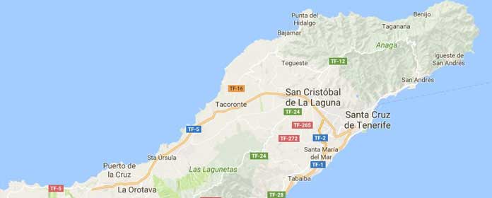
It’s noticeable how all three of the major cities are lie in the northern parts of the island. Puerto de la Cruz, Santa Cruz de Tenerife and San Cristóbal de la Laguna. To the south of the Anaga Mountains.
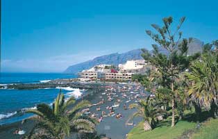
Santa Cruz de Tenerife Map
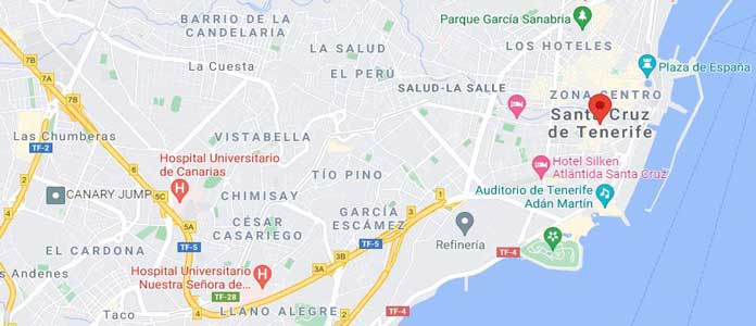
Below the Anaga Mountains is the city of Santa Cruz de Tenerife (picture above) and San Cristóbal de la Laguna. Santa Cruz is the capital of Tenerife and joint capital of the Canary Islands. These two cities are the biggest on the island. Close to half of the island’s population lives in Santa Cruz and the outskirts. A tram system links these cities together. Tenerife North Airport lies to the west of San Cristóbal.
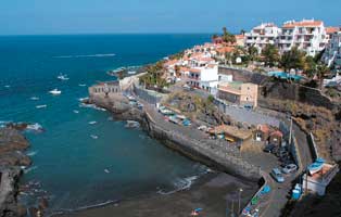
Puerto de la Cruz Map
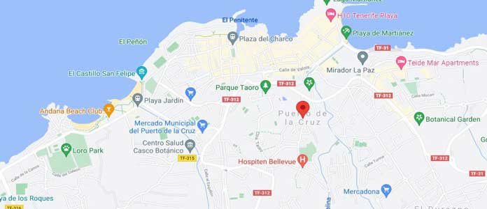
Puerto de la Cruz is the another city which lies in the north of the island. This city has the smallest land mass and population. Puerto de la Cruz belongs to the La Orotava region. This region is famous for it’s lucrative sugar cane and wine production and exportation. On the outskirts of Puerto de la Cruz city is the popular Loro Parque (Parrot Park) tourist attraction. This is one of the leading attractions on the island.
Los Gigantes

Los Gigantes gets it’s name from the massive Acantilados de Los Gigantes (Cliffs of the Giants). This is one of the major tourist attractions on the island of Tenerife. The image above of the cliffs comes from the rock pools. This area offers amazing panoramic views of the Atlantic Ocean. The popular resorts of Puerto de Santiago and Playa de la Arena are both lie within 3 km’s to the south.
Map of Tenerife South & Popular Resorts
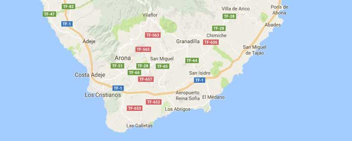
Much of the southern region of Tenerife is where you will find the top tourist resorts. These include Los Cristianos, Playa de las Américas and Costa Adeje. There are many others dotted around the island that we are yet to cover. We plan on adding these in due course.
Los Cristianos Map
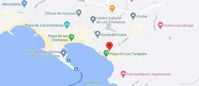
Los Cristianos is a popular area and resort close to the southern tip of Tenerife. One of the eye-catching parts of Los Cristianos is the harbour with the Guaza Mountains. There are two beaches to choose from here including Las Vistas and Playa de los Cristianos. Hotels, bars and restaurants have been springing up here in the last 10 years. Development has continued from the coastal areas inland.
Playa de las Américas Map
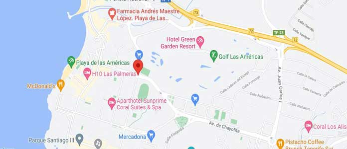
Playa de las Américas is a custom built tourist resort and the number one destination on the island. This area is famous for it’s vibrant nightlife and imported sandy beaches from the Sahara Desert. Many tend to stay in the quieter resorts and head here for the party atmosphere on offer. Troya is the top beach in Playa de las Américas with the locals favouring the beaches of El Camison and El Puerito. Las Américas Golf is a beautiful golf course that was constructed in 1988.
Costa Adeje Map
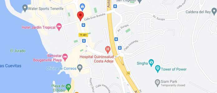
Costa Adeje is north of of Los Cristianos and Playa de las Américas. The area of Costa Adeje is generally considered more sophisticated. This area boasts the beautiful beach resorts of Playa del Duque and Playa Fañabe. There are also two amazing water parks. Aqualand is a traditional water park one would expect in most tourist destinations. Siam Park is a Thai-Themed water kingdom with thrilling water rides and it’s own little beach. Costa Adeje is known for it’s fantastic weather thanks to the shielding provided by Mount Teide. in the centre of the island.
Resorts Map
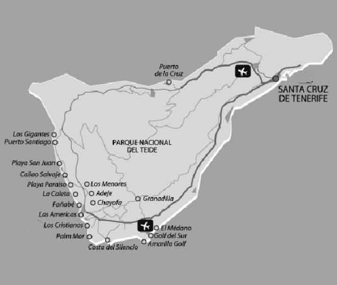
Below is a map of the Tenerife resorts, major cities and popular tourist areas (click to enlarge). This link will take you to our top resorts guide if you are still deciding where to go.
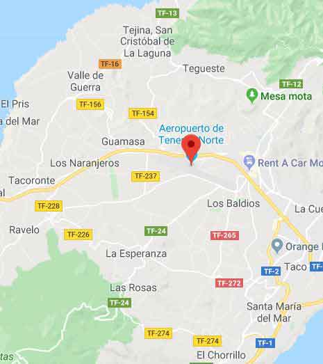
Tenerife North Airport Map
The image below is the map of Tenerife North Airport. You can click the image for the the full size interactive map on Google. This airport lies in San Cristóbal de La Laguna, near the capital Santa Cruz de Tenerife.
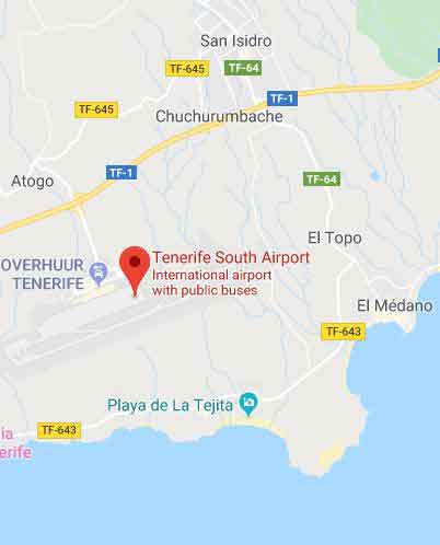
South Tenerife Airport Location
Below is Tenerife South Airport map which you can click to see in full size on Google. This airport lies in the municipality of Granadilla de Abona and is the busier of the two airports.
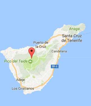
Tenerife Central
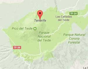
In the centre of Tenerife is the huge volcano Mount Teide and Teide National Park. Only 2 other volcanoes in the Hawaiian islands stand taller. Teide has a total height of 3718 metres, this happens to be the highest point in Spain.
Playa de la Arena
Playa de la Arena lies around 3 km’s south of Los Gigantes and less than 2 km’south of Puerto de Santiago. This area is much more tourism orientated than some resorts along the western coast. Here there are plenty of bars, restaurants and hotels. Blue Flag certification has previously be awarded to the black sand beach here. The best known hotel resorts here are Barcelo Varadero and Playa de La Arena.
Puerto de Santiago
Puerto de Santiago lies on the western coastline, around 1 km south of Los Gigantes. This is a much quieter resort than most but still ideal for family holidays. There is a small black sand beach here that is never gets too busy. This resort has several more smaller beaches also. Boating is particularly popular in Puerto de Santiago. there are plenty of bars and restaurant serving up a variety of Canarian Cuisine.